We Empower Commercial Real Estate Insurance Companies with Advanced GIS Risk Assessment Solutions.

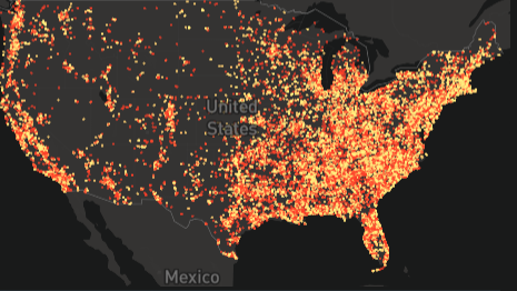
FineSoft Solutions is a PropTech company that uses powerful Geographic Information System (GIS) and AI technology to assist CRE insurers in assessing the risk of its potential and current insured clients through spatial and geographic data analysis.

About Us

We are a US based Proptech firm based in New York and Florida that aims to provide specialized GIS and AI solutions for CRE insurers using customized ESRI software.

Mission.

Our mission is to revolutionize risk assessment in the CRE insurance industry by harnessing the power of GIS and AI technologies. We are committed to providing our clients with unparalleled insights and solutions that drive financial success, operational efficiency, and resilience in the face of evolving CRE risks.

Our Value:

Risk Assessment

We use GIS to analyze spatial data related to property characteristics, environmental factors, natural hazards, and proximity to critical infrastructure. By mapping and visualizing these data layers, we identify potential risks associated with insured properties and assess their impact on insurance portfolios.

Loss Prevention

GIS helps in identifying areas prone to risks such as flooding, earthquakes, or fire hazards. By analyzing historical loss data, environmental factors, and property characteristics, we develop strategies for mitigating risks and preventing losses.

Portfolio Management

GIS enables commercial real estate insurance companies to manage their portfolios effectively. We use spatial analysis techniques to assess portfolio diversification, concentration of risk, and exposure to high-risk areas. This information helps in optimizing portfolio performance and making informed underwriting decisions.

Market Analysis

GIS supports market analysis by mapping real estate trends, market dynamics, and competitive landscapes. We analyze spatial data on demographic characteristics, economic indicators, and property values to identify market opportunities, assess market risks, and support strategic decision-making.

Claims Management

GIS assists in streamlining claims management processes by providing spatial insights into property damage, loss events, and claims frequency. By mapping claims data and analyzing spatial patterns, we identify trends, prioritize claims, and allocate resources more efficiently

Why Work With Us?

We have specialized GIS expertise and knowledge. We know how risky it can be to insure CRE properties in an everchanging CRE market and we want to help you reduce those risks.

We offer contract flexibility and tailored solutions that adapt to your needs, ensuring you get the most value for your investment. With our team’s deep understanding of GIS and AI technologies, we deliver precise insights and solutions that empower you to navigate complex risk environments with confidence and powerful technology.

Advanced specialized data analytics for CRE insurers.

We help you make informed decisions.

Your Trusted Partners

Highly Motivated Team

We love what we do and therefore come up with tailored solutions together that best fits your needs.

Subscribe to our Newsletter

Email
The form has been submitted successfully!
There has been some error while submitting the form. Please verify all form fields again.